
On our second day in Death Valley National Park, my sister, Lynda, and I moved the RV to Furnace Creek Campground where we had reservations for the duration of our stay. It’s a large campground with 136 spots, but no showers. In fact, none of the 3 campgrounds in Furnace Creek have showers so you have to either have your own (we did—yay!) or go to the hotel nearby and pay to use their shower facilities. There are only a few hook-up spots too, so we were using our own power and water while we were there.
Furnace Creek Campground is conveniently located near the National Park Visitor Center, so we stopped by for a visit, but then it was on to more site-seeing and hiking. We had a full agenda for our stay, so there was no time to lose!
We had already done our Jeep tour in the morning (click here to read about that in Death Valley NP Part I), and for the afternoon we wanted to get in a nice hike. Mosaic Canyon was exactly what we were looking for.

The first part of the hike through Mosaic Canyon was pretty easy. Years of flash flood waters running down through the canyon have carved out the 4 mile roundtrip trail (2 each way). It goes back and forth between wide open washes to some really beautiful narrows. In parts of the narrows, the rocky sides have been polished into beautiful sweeping marble designs. In other places, we saw how the canyon got its name with boulders made up literally of rock mosaics.

After hiking for a little over a mile (best guess), the terrain got a little trickier with some scrambling over boulders involved. At the first scrambling spot, an arrow directed us to a slightly easier side route (although still not super easy). If you can manage it, a little bouldering is worth the effort to continue up the trail.
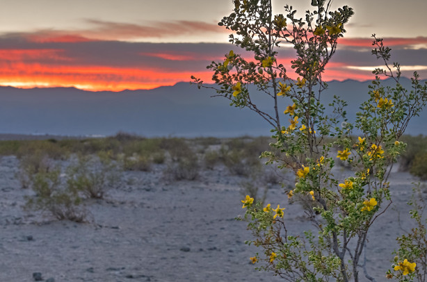
We came out of Mosaic Canyon just before sunset and had plans for nearby Mesquite Dunes for that. Unfortunately, we didn't leave ourselves much time at the dunes, and frankly, it’s probably way better for sunrise with a lot fewer people. But it was still beautiful and the sunset that night was really crazy. Parking for the dunes is next to the road and you can walk out onto them as far as you’d like right from there. The photos below from farther away were taken before we got to the dunes.
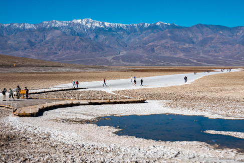
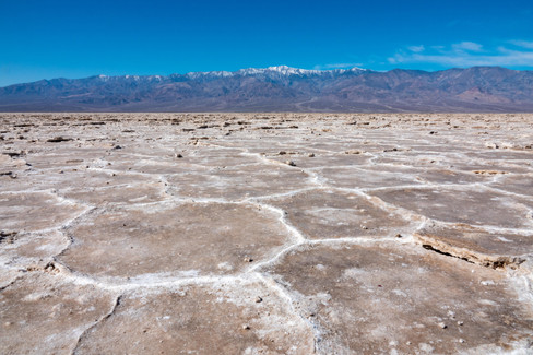
The next day we had another full day planned, starting with Badwater Basin. It’s an iconic site to see in Death Valley and an easy walk out onto the salt flats. It’s the lowest spot in North America at -282 ft below sea level. At one time, a giant lake covered Badwater Basin. As Lake Manly dried up and evaporated 10,000 years ago, concentrations of salt and minerals were left behind on the surface in the shape of polygons. Photographers who visit the area are drawn to these as they are so dramatic and unusual. Unfortunately, we were there a little late in the morning to get the good shadows on the geometric designs. You need to walk out a little ways to see the shapes--closer to the parking lot the salt is very clumpy. Also, unfortunately, near the path, the edges of the polygons have been stepped on and broken off so in order to get a really clean look, you would probably have to hike out onto the flats quite a bit farther than we did. The white path that looks like snow is the salt packed down from millions of footsteps over the years. As you’re walking back to the parking lot, look up onto the side of the cliff and you will see a sign indicating where sea level is. Badwater Basin is a must see site for any Death Valley visitor, even if you don’t have much time.
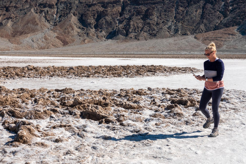
Our next two stops were at golf courses. Yep, you heard that right. Death Valley has not one, but TWO golf courses. Okay, maybe there’s only one actual golf course, but The Devil’s Golf Course was on our way back into town where we had plans to play the one that has real tees and greens. The boulder-like clumps are once again made up of salt. It’s hard to get a good perspective on their size without someone in the photo, so I got a picture of Lynda “playing” the course.
Furnace Creek Golf Course is in the little town of Furnace Creek and is associated with the Oasis at Death Valley hotels. At -214 below sea level it has he distinction of being the world’s lowest elevation golf course. I love how they use that play on words for their scorecard caddy! There were some ponds on the course and the Audubon Society has certified it as an Audubon Cooperative Sanctuary. The course itself was designed by Perry Dye, son of the famous golf course designer Pete Dye. It’s interesting to play, but the greens are VERY rough. After the round, you can get a beer and hamburger at the 19th Hole Bar and Grill.
I have a few more sites I’ll be adding in Death Valley Part III, including our favorite hike of the entire trip. Before starting this adventure, I never dreamed it would take me three separate posts to cover all that we did there, but as I found out, there is a lot to do and it’s all very different. I ended up taking a ton of photos. Narrowing them down to just a few for each location was REALLY hard (I obviously didn’t do a very good job). Just know that there were sooooo many more I could have added. Death Valley is VERY photogenic.



























Comments